No single accuracy percentage is quoted below. The differentiator is a calibrated interval on every value, benchmarked against the utility's own in-situ sampling — and an honest account of what optical sensing cannot see.
A · ACCURACY & VALIDATION
Can I trust a satellite quality value enough to act?
You act on it because it arrives with its confidence attached. Each pixel value is a conformal prediction interval with guaranteed coverage, so a clear-water chlorophyll estimate carries a tight band while a turbid or shadowed pixel carries a wide one. The uncertainty sits right on the value instead of being buried somewhere else. Water-quality proxies are benchmarked against the operator's in-situ grab samples and probe data, and that becomes the reference the satellite layer is calibrated and checked against.
- Independent reference. Your own sampling network is the ground truth; matchups are reported, not averaged away.
- Honest flagging. Scenes too clouded, shallow or optically complex to resolve are flagged rather than filled.
- Validation pack. Matchup tables and coverage statistics ship with the product and stay current.
B · RESOLUTION & UPDATE FREQUENCY
How fine, how often?
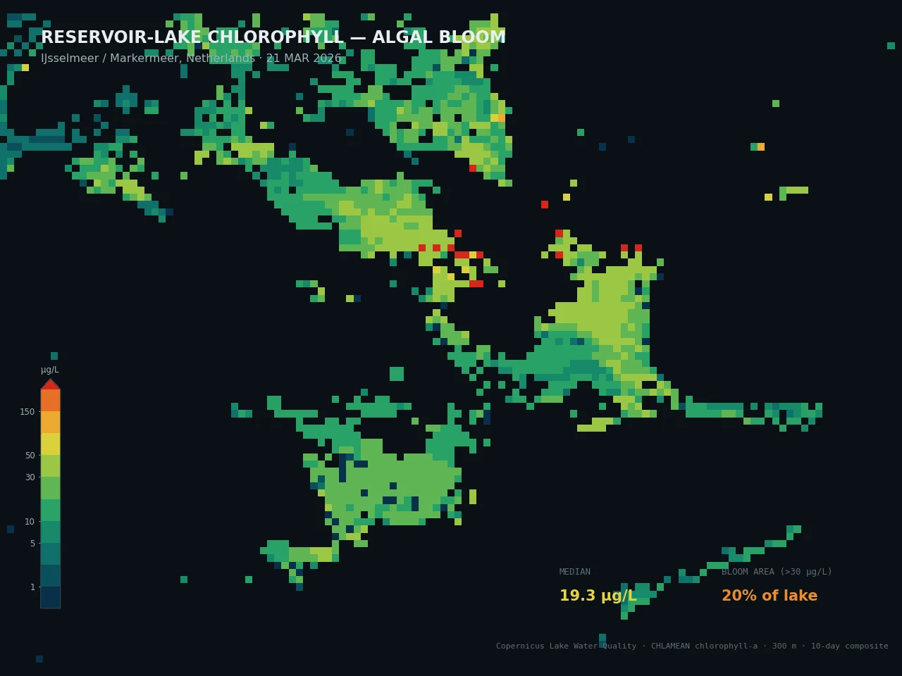
Spatial: per-pixel mapping across the water body, resolving bloom patches, inflow plumes and near-shore zones separately from open water.
Temporal: refreshed on each clear satellite pass; optical and thermal sensing require clear sky, so revisit density depends on cloud climatology.
C · INTEGRATION
How does it reach my systems?
- API — per-zone and per-pixel quality values plus intervals.
- GeoTIFF — georeferenced quality rasters for GIS.
- PDF report — quality brief for operations and regulatory files.
- Threshold alerting feed — pushed to your systems, not a dashboard to watch.
The API delivers tag-style values and intervals, and a SCADA / treatment-control system can ingest them as derived quality inputs sitting alongside intake instrumentation.
D · TECHNOLOGICAL LIMITATIONS — HANDLED HONESTLY
Optical sensing reads the surface — not the deep or the turbid column
Here's the central honest limit. Optical instruments measure the near-surface optical signal, so they can't see a deep chlorophyll layer below the surface, and very turbid or shallow water confounds the retrieval — we don't pretend otherwise. So we mitigate on three fronts: (1) retrievals are calibrated against the operator's in-situ samples for that specific water body, correcting for local optical conditions; (2) every value carries an interval that widens for turbid, shallow or optically complex pixels, making the low-confidence areas obvious; (3) thermal sensing adds surface-temperature context that helps flag stratification and bloom-favourable conditions even where the optical retrieval is weak.
Cloud blocks optical and thermal passes entirely. When that happens we state the gap explicitly rather than interpolating a quality value across days with no observation.
E · COMPLIANCE & STANDARDS
Where it fits
Outputs are designed to support source-water and bathing-water monitoring and environmental reporting, providing wall-to-wall context that targets where in-situ sampling should go. Processing runs under EU data residency.
We don't claim that a satellite proxy is a certified laboratory measurement, and we say so. The layer prioritises and complements regulatory sampling. It does not replace the accredited test a standard requires.
F · DELIVERY FORMATS
What you actually receive
- API with per-zone / per-pixel quality values + intervals
- GeoTIFF quality raster layers
- Vector tables (CSV / GeoPackage)
- PDF quality and event reports
- Threshold alerting; SCADA-ingestible feed
G · HORIZON
What time frame it speaks to
The product is primarily near-real-time surveillance. It surfaces a developing bloom or turbidity event across the whole water body as soon as a clear pass is processed, well ahead of when a routine sampling schedule would catch it. Where conditions are well observed, it also supports a short-range outlook on bloom-favourable conditions, always paired with a quantified confidence rather than served up as a hard prediction.